 PowerDelivery
For parcel carriers · Android
Scan the parcels. Drive the best route. No signal needed.
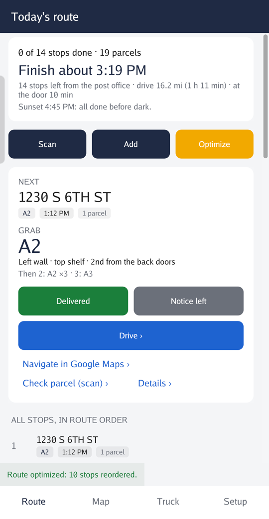
PowerDelivery reads the day's parcels off their labels, orders the stops along the real roads, tells you when the day will end and where each parcel rides in the truck. The area's map is downloaded once; after that it works with no signal.
Works for USPS, UPS, FedEx, Royal Mail, An Post and other couriers, in the US, the UK and Ireland.
Why carriers use it
Built for the parts of the route with no bars.
Most route apps stop working when the phone loses its signal. PowerDelivery keeps the map, the router and the label reader on the phone, so the day goes on whether or not the network does.
It works where the signal doesn't
Rural routes, basements, the far end of an estate: the map, the routing, the label reading and the voice are all on the phone. It downloads your area once, on Wi-Fi, and after that it needs nothing.
The order a truck can actually drive
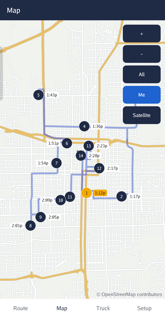
Stops are ordered along the area's real roads, one-way streets and turn restrictions included, with guaranteed delivery times kept. In a right-hand-drive truck it goes round the block by the curb side, so you are never crossing the street to a door.
Know when the day ends
Driving, walking loops, time at each door, breaks and the run back to the depot, added up from where you are. As the day goes on it learns your real pace, so the finish time is yours rather than a guess.
Your day
From the loading dock to the last door.
Scan the label, at any angle
Point the camera at a parcel. PowerDelivery reads every barcode on the label and the address beside it, turned sideways or upside down, drawing the text it reads over the picture as it goes. Parcels for one address become one stop.
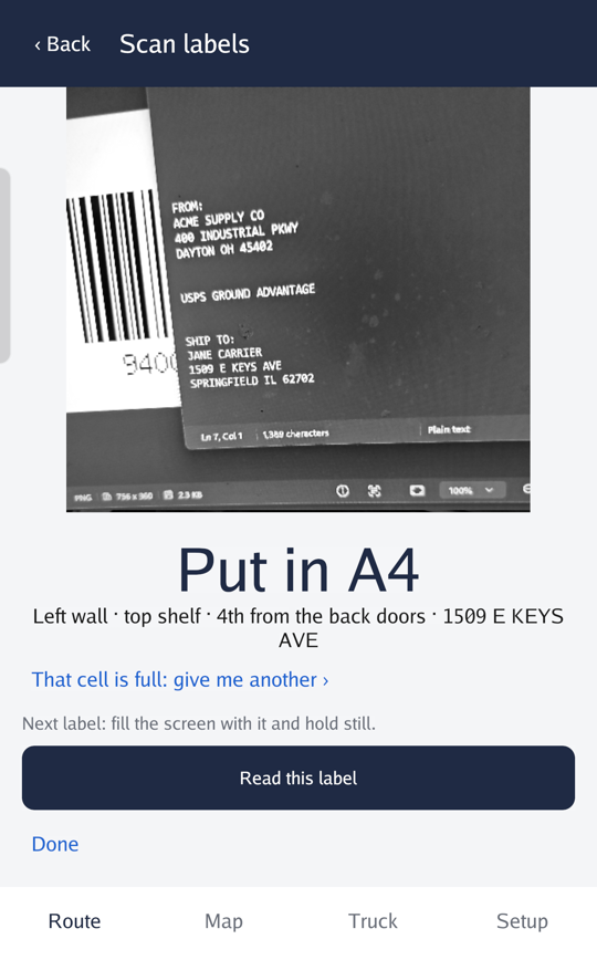
Every parcel has its place in the truck
As you scan, each parcel gets the next shelf with room, and a stop's parcels stay together. At every stop the app says which cells to reach into, with the next stops lit in a 3D view from the back doors.
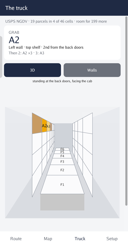
The route, in order, with the finish time
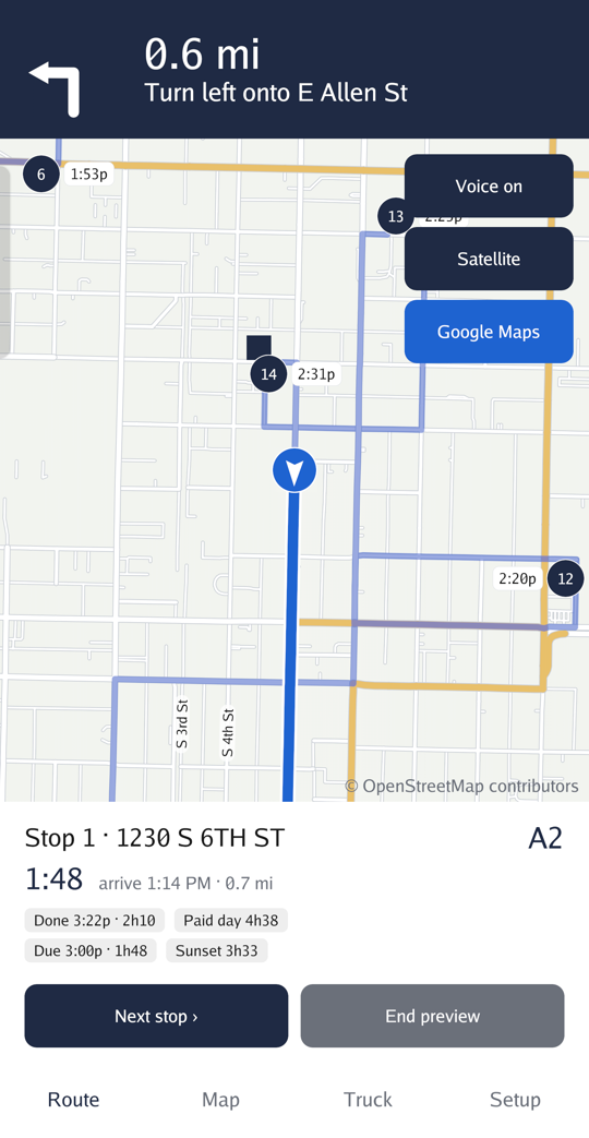
The next stop and what to grab, when you will get back, and the guaranteed parcels' deadlines, all on one screen. Re-optimize from where you are whenever the day changes.
Turn-by-turn, spoken, offline
The next turn big on the screen and spoken in the phone's own voice, the side of the road the stop is on, and a warning before an Express deadline or the end of the paid day. Hand a leg to Google Maps when you want live traffic.
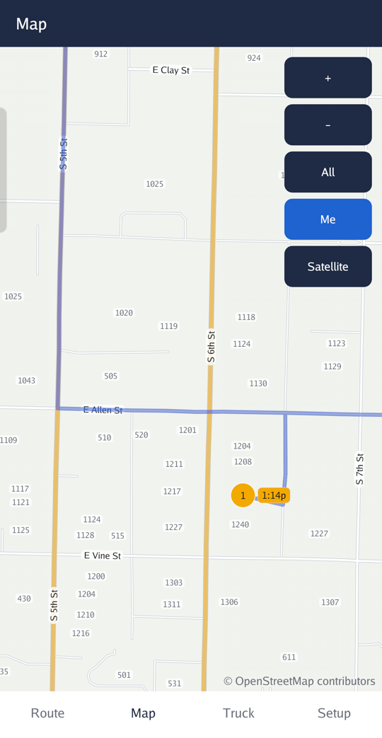
Every house, with its number
Zoom in and street names run along the streets and each house shows its number. Where a house has none, tap it and number it yourself; it is kept on the phone from then on.
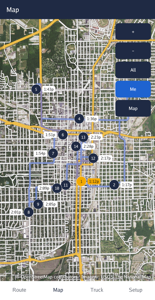
Satellite view, even with no signal
Aerial photos under the roads. In the US the USGS's are downloaded once with the map; in the UK and Ireland they load while there is a signal and stay on the phone.
Where it works
Your country's roads, units and postcodes.
Pick the country and who you deliver for. The side of the road, the units, the clock, the postcodes and the voice follow.
United States
USPS, UPS, FedEx or another courier. Miles and feet, ZIP codes, and the guaranteed times each carrier sells. The NGDV and LLV are routed as the right-hand-drive trucks they are.
United Kingdom
Royal Mail, UPS, FedEx or another courier. Driving on the left, miles and yards, a 24-hour clock, and labels read by their postcode, including Royal Mail's Mailmark code.
Ireland
An Post, UPS, FedEx or another courier. Kilometres, Eircodes and routing keys, house names and townlands where a house has no number.
Questions
What carriers ask first.
+Does it need a signal?
Only once, to download your area's map, ideally on Wi-Fi. After that scanning, routing, the map and the spoken directions all work with no signal at all.
+Which carriers does it work for?
USPS, UPS, FedEx, Royal Mail, An Post, or any other courier. The carrier sets where the day starts from, the vehicles offered and the guaranteed delivery times a parcel can carry.
+Is it made by my carrier?
No. PowerDelivery is made by Unidatum and is not affiliated with or endorsed by USPS, UPS, FedEx, Royal Mail, An Post or any carrier.
+What does it need?
An Android phone running Android 10 or later, with a camera for scanning labels. The app is about 45 MB, and a map of a five-mile area is a few more.
+Does it send my route anywhere?
No. Your stops, parcels and where you have been stay on the phone. The only things it fetches are the map, satellite photos and extra addresses for your area, and those requests name the area, not you.
+What if an address is not on the map?
Place the stop by hand, or deliver it and press Delivered: the app remembers where the door is and finds it there next time.
Tomorrow's route, planned before you leave the dock.
Install it, pick your depot and your vehicle, and download your area once. Then scan.
Not affiliated with or endorsed by USPS, UPS, FedEx, Royal Mail, An Post or any carrier. Map data © OpenStreetMap contributors.